|
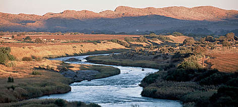
- The Zambezi is the fourth-longest river in Africa, the longest east flowing river in Africa and the largest flowing into the Indian Ocean from Africa. The area of its basin is 1,390,000 square kilometres, slightly less than half that of the Nile and stretches 1599 miles. -The Orange River, Gariep River, Groote River or Senqu River is the longest river in South Africa. It rises in the Drakensberg mountains in Lesotho, flowing westwards through South Africa to the Atlantic Ocean about 1367 miles. -The Okavango River is a river in southwest Africa. It is the fourth-longest river system in southern Africa, running southeastward for 684 miles. It begins in Angola, where it is known as the Cubango River |

|
Heavy rains fell across southern Africa in early 2011. By early February, river flooding in South Africa alone had killed 91 people and caused over $100 million in damage, the United Nations stated. Times Live reported that the government had issued flood warnings for areas along the Orange, South Africa’s longest river.
The Moderate Resolution Imaging Spectroradiometer (MODIS) on NASA’s Terra satellite captured these false-color images of South Africa on February 13, 2011 (top), and February 19, 2010 (bottom). Both images use a combination of visible and infrared light to increase the contrast between water and land. Water ranges from blue to navy. Vegetation is green. Bare ground varies in color from pink-tan to brown. Clouds are pale blue-green or off-white, and often cast shadows onto the land surface below.
Compared to 2010, a general green-up is apparent in 2011. In 2010, the Orange River is easily spotted, thanks to the bright green riverbanks lined with irrigated crops and the relatively brown land nearby. In 2011, clouds partially obscure the river, which is less conspicuous because so much of the region has turned green. North of Brandvlei in 2011, standing water sprawls over large areas that had been dry a year before.
Groblershoop was among the many communities along the Orange River that had suffered from flooding in early 2011. Times Live reported that orchards around the town had been overwhelmed by flood waters, and farmers in the area were bracing for heavy losses. The UN Food and Agriculture Organization (FAO) warned that southern Africa could face food insecurity as a result of the floods. Further, the FAO warned that, with the seasonal rainy season only halfway over, South Africa might face its worst floods in decades.
- References
- Times Live. (2011, February 2). Urgent flood warning along Orange River. Accessed February 14, 2011.
- United Nations Integrated Regional Information Networks. (2011, February 10). Southern Africa: Risk of food insecurity in wake of floods. IRIN News. Accessed February 14, 2011.
- Voice of America. (2011, February 7). Southern Africa may face worst flooding in decades. Accessed February 14, 2011.
Congo River, formerly Zaire River, river in west-central Africa. With a length of 2,900 miles (4,700 km), it is the continent’s second longest river, after the Nile. It rises in the highlands of northeastern Zambia between Lakes Tanganyika and Nyasa (Malawi) as the Chambeshi River at an elevation of 5,760 feet (1,760 metres) above sea level and at a distance of about 430 miles (700 km) from the Indian Ocean. Its course then takes the form of a giant counterclockwise arc, flowing to the northwest, west, and southwest before draining into the Atlantic Ocean at Banana (Banane) in the Democratic Republic of the Congo. Its drainage basin, covering an area of 1,335,000 square miles (3,457,000 square km), takes in almost the entire territory of that country, as well as most of the Republic of the Congo, the Central African Republic, eastern Zambia, and northern Angola and parts of Cameroon and Tanzania.
